
The Role of High-Fidelity Simulation in Urban Planning
For generations, the future of our most complex urban environments was decided on flat surfaces. City planners, civil engineers, and municipal developers relied on two-dimensional zoning maps, localized environmental impact spreadsheets, and static CAD drawings to orchestrate the growth of massive, interconnected metropolises. We attempted to manage living, breathing, three-dimensional ecosystems using tools that fundamentally stripped away the physical reality of how a city actually operates.
Today, as urbanization accelerates and climate volatility becomes the baseline operating condition of our planet, this legacy approach to urban planning is no longer just outdated—it is actively dangerous. A city is not a static grid of concrete and steel; it is a highly sensitive, multi-variable biological system. When you introduce a massive new infrastructure project into an existing urban fabric, it does not sit in isolation. It permanently alters the aerodynamic, thermal, and logistical reality of everything around it. To build resilient, low-carbon cities for the next century, we must completely abandon the static zoning map and embrace the era of high-fidelity, physics-based simulation.
The Death of the Static Zoning Map
Historically, when a developer proposed a massive new commercial complex or a municipal transit hub, the environmental and structural impact studies were heavily localized. The civil engineers would calculate the load-bearing capacity of the immediate soil, and city planners would estimate the localized traffic surge.
But traditional urban planning tools fail to capture the cascading, invisible physical forces that a new development unleashes. A fifty-story glass skyscraper does not just occupy airspace; it acts as a massive thermal battery, absorbing solar radiation during the day and releasing it at night, actively exacerbating the urban heat island effect for surrounding neighborhoods. Its structural geometry interacts with atmospheric currents, potentially creating violent pedestrian-level wind tunnels. Its foundation alters subterranean hydrology, shifting how stormwater drains during a severe weather event.
Static blueprints and traditional predictive analytics cannot calculate these multi-variable, interconnected phenomena. They can tell you what the building will look like, but they cannot tell you how it will physically behave. We have been building blind to the physical consequences of our own infrastructure.
High-Fidelity Physics-Based Digital Twins
The solution lies in high-fidelity simulation. In the context of the built environment, "high-fidelity" means moving beyond a simple 3D visual model and transitioning to a physics-based digital twin.
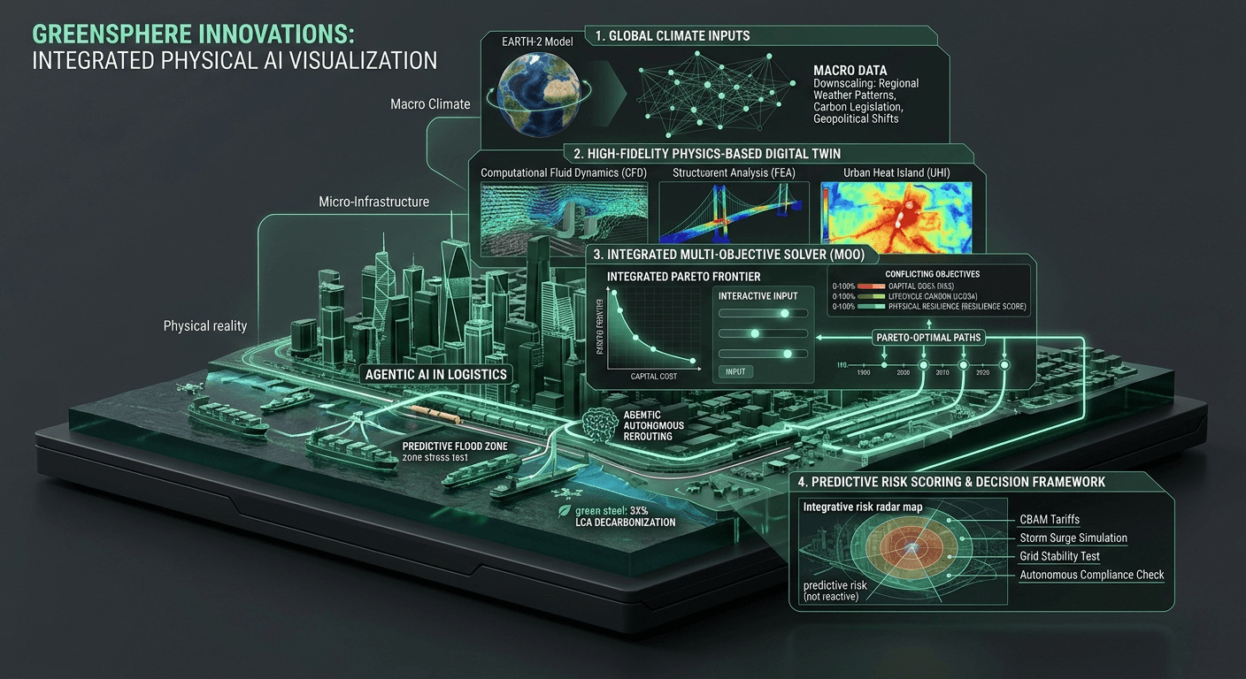
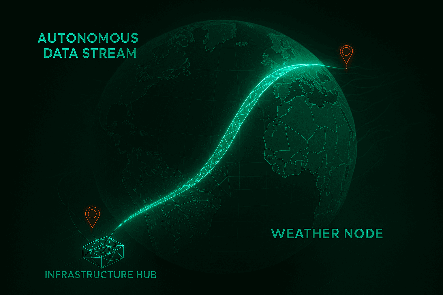
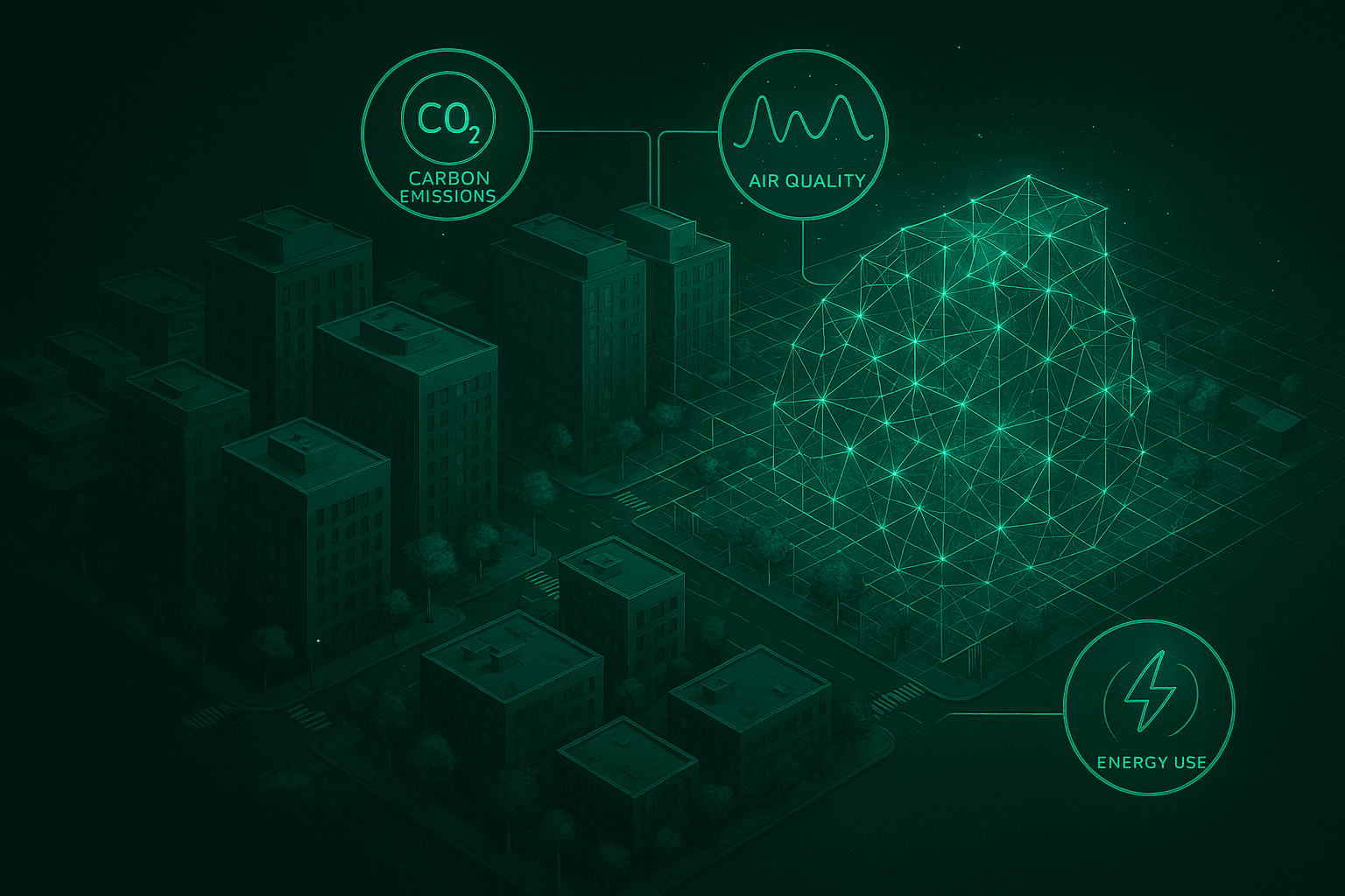
A digital twin is a dynamic, virtual replica of a physical asset that is entirely governed by the strict, deterministic laws of physics. At GreenSphere Innovations, our digital twin architecture does not just render the geometric shape of a city block; it computes the thermodynamics, fluid dynamics, and structural mechanics of that block. By ingesting massive arrays of topographical, meteorological, and material data, we create a computable ecosystem.
When urban planners utilize a high-fidelity simulation, they can drop a proposed infrastructure project into a GreenSphere digital twin of the city and literally watch the physics react. They can run Computational Fluid Dynamics (CFD) to visualize exactly how the new building will alter wind patterns. They can simulate localized solar radiation to measure the exact temperature increase on adjacent streets. By providing a mathematically precise window into the future, we allow planners to identify and engineer out environmental hazards before a single permit is issued or a single drop of concrete is poured.
Breaking the City-Scale Compute Bottleneck
If high-fidelity simulation is so transformative, why hasn't it been the standard for the last decade? The answer brings us back to the core thesis of GreenSphere Innovations: the computational bottleneck.
Running a true, physics-based simulation on a single building requires immense processing power. Attempting to run those same non-linear, dynamic calculations across an entire interconnected city grid—simulating millions of structural and environmental interactions simultaneously—historically brought traditional CPU-bound enterprise servers to a grinding halt. Planners were forced to artificially limit the fidelity of their models or drastically shrink their exploration space simply to make the math computationally tractable.
By leveraging massively parallel GPU-accelerated computing, we are eliminating this barrier. GPU inference cores are explicitly designed to handle the simultaneous, multi-variable calculations required by fluid dynamics and structural mechanics. Workloads that previously took weeks of rendering time can now be executed in minutes. This unprecedented speed allows for true Multi-Objective Optimization (MOO) at a municipal scale. City planners can now run ten thousand permutations of a development project, tweaking building orientations, material selections, and green space integrations, until the algorithm finds the exact Pareto-optimal design that balances capital cost, carbon lifecycle, and physical resilience.
Predictive Urban Resilience
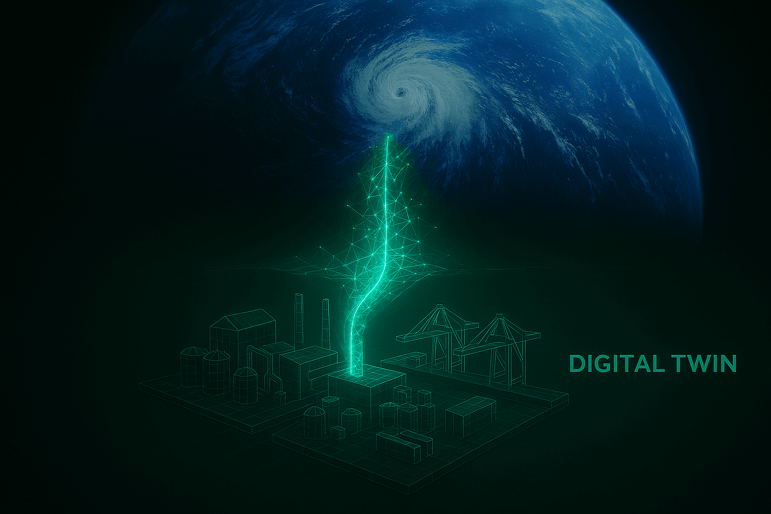
The ultimate value of high-fidelity simulation is predictive resilience. As climate change accelerates, cities will be tested by unprecedented weather events. We can no longer afford to learn where our urban infrastructure is vulnerable by waiting for it to fail during a flash flood or a grid-collapsing heatwave.
Using GPU-accelerated digital twins, planners can subject entire city districts to adversarial, simulated climate events. They can model a Category 5 hurricane storm surge pushing against coastal developments, identifying the exact sub-surface drainage nodes that will fail first. They can then dynamically simulate the integration of new sustainable infrastructure—like permeable pavements or strategic seawalls—and instantly verify their effectiveness in mitigating the damage.
We are giving civil engineers and municipal leaders the power to stress-test the future.
The GreenSphere Vision
The transition to sustainable smart cities requires more than sensor-laden streetlights and digital dashboards. It requires a fundamental evolution in how we compute and understand the physical world. We must stop treating urban planning as an exercise in two-dimensional zoning and start treating it as the complex systems engineering challenge that it is. At GreenSphere Innovations, we are building the high-performance computational infrastructure necessary to make this a reality. By providing the tools to run high-fidelity, physics-based simulations at scale, we are ensuring that the cities of tomorrow are not just built to exist, but engineered to survive and thrive.